
Tiệc họp mặt Sherbrooke 08-2006
 Khiết Mỹ Quang Đoan Minh Trang Thanh
Mỹ Khiết Thanh Minh Đoan Quang Trang


Sân nhà Kim Đoan

 Đoan Minh Khiết Quang Thanh Mỹ Trang Liên
Thanh Mỹ Đoan Lượng Minh Nhân Khiết Quang Tuấn Trang Cương
 Đoan Quang
----------------------------------------------------------------------------------------------------------- Minh Đan- Vân Anh Quang Đoan A.Tân 1992 trong sân Đại Học Sherbrooke
Giọt nắng bên thềm Trình bày Thanh Lam
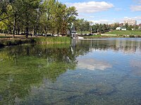
Một vài nét về tỉnh Sherbrooke (Québec CANADA)
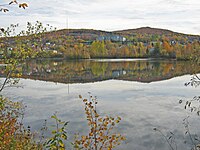
Hình ảnh mùa Thu Sherbrooke
 Đoan Quang
-----------------------------------------------------------------------------------------------------------
 Minh Đan- Vân Anh Quang Đoan A.Tân 1992 trong sân Đại Học Sherbrooke
Giọt nắng bên thềm Trình bày Thanh Lam
Một vài nét về tỉnh Sherbrooke (Québec CANADA)
Hình ảnh mùa Thu Sherbrooke
Charles A.Tú đã làm quảng cáo cho phân khoa Kỹ Sư của đại học Sherbrooke khi cháu tốt nghiệp kỹ sư điện toán vào năm 2005 và youtube này do đại học Sherbrooke thực hiện.
Nguồn Wikipedia
Sherbrooke
From Wikipedia, the free encyclopedia
This article is about the city in Quebec, Canada. For other uses, see Sherbrooke (disambiguation).
| Sherbrooke | |||||
|---|---|---|---|---|---|
| — City — | |||||
 |
|||||
|
|||||
| Nickname(s): Queen of the Eastern Townships | |||||
| Motto: Ne quid nimis | |||||

Sherbrooke
|
|||||
| Coordinates (191, rue du Palais[1]): 45°24′N 71°54′WCoordinates: 45°24′N 71°54′W[2] | |||||
| Country | |||||
| Province | |||||
| Region | Estrie | ||||
| RCM | None | ||||
| Settled | 1793 | ||||
| Constituted | January 1, 2002 | ||||
| Boroughs | |||||
| Government[1] | |||||
| • Type | Sherbrooke City Council | ||||
| • Mayor | Bernard Sévigny | ||||
| • Federal riding | Compton—Stanstead and Sherbrooke | ||||
| • Prov. riding | Richmond, Saint-François and Sherbrooke | ||||
| Area[1][3] | |||||
| • City | 367.10 km2 (141.74 sq mi) | ||||
| • Land | 353.49 km2 (136.48 sq mi) | ||||
| • Urban[4] | 171.04 km2 (66.04 sq mi) | ||||
| • Metro[5] | 1,459.61 km2 (563.56 sq mi) | ||||
| Highest elevation | 378 m (1,240 ft) | ||||
| Lowest elevation | 128 m (420 ft) | ||||
| Population (2011)[3] | |||||
| • City | 154,601 | ||||
| • Density | 437.4/km2 (1,133/sq mi) | ||||
| • Urban[4] | 140,628 | ||||
| • Urban density | 822.2/km2 (2,129/sq mi) | ||||
| • Metro[5] | 201,890 | ||||
| • Metro density | 138.3/km2 (358/sq mi) | ||||
| • Change (2006–11) | |||||
| • Dwellings | 75,880 | ||||
| Time zone | EST (UTC−5) | ||||
| • Summer (DST) | EDT (UTC−4) | ||||
| Postal code(s) | J1E to J1R | ||||
| Area code(s) | 819 | ||||
| Access Routes[6] |
|||||
| Telephone Exchanges | -212 239 340 345-9 432 434 437 446 542 560 -6 569 570 - 4 575 577 | ||||
| GNBC Code | EIDHN | ||||
| NTS Map | 021E05 | ||||
| Website | www.ville.sherbrooke.qc.ca | ||||


Originally known as Hyatt's Mill, it was renamed after Sir John Coape Sherbrooke (1764–1840), a British soldier who was Lieutenant Governor of Nova Scotia (1812–1816), and Governor General of British North America (1816–1818).
Sherbrooke is the primary economic, political, cultural and institutional centre of Estrie, and was known as the Queen of the Eastern Townships at the beginning of the 20th century.
Sherbrooke is an important university center with eight institutions educating 40,000 students and employing 11,000 people (3,700 of whom are professors, teachers and researchers).[7] The direct economic impact of these institutions exceeds 1 billion dollars.[7] The proportion of university students is of 10.32 students per 100 inhabitants. In proportion to its population, Sherbrooke has the largest concentration of students in Quebec.[8]
Since the nineteenth century, Sherbrooke has also been an important manufacturing center, although this segment of the economy has experienced a considerable transformation in recent decades as a result of the decline of the city's traditional manufacturing sectors. Today, the service sector occupies a prominent place in the economy of the city, as well as a growing knowledge-based economy.[9]
The Sherbrooke region is surrounded by mountains, rivers and lakes. There are several ski hills nearby and various tourist attractions in regional flavor. Mont-Bellevue Park, a large park in the city, is used for downhill skiing.
Contents |
History

Upon the arrival of Samuel de Champlain to Quebec in 1608, this region was under the control of the Mohawks. France created an alliance through its missionaries with the Abenaki, located in Maine and Vermont. The French were driven to the valley of St. Lawrence River near Trois-Rivières after a Mohawk victory in the war of 1660. Seeking to obtain control of the territory, the area around present-day Sherbrooke was a battlefield between the two peoples who had to travel to the region.
During the Seven Years War between France and Britain, the Abenaki, still allied with the French, traveled along the rivers of the Eastern Townships, frequently near present-day Sherbrooke during British raids. The Treaty of Paris was signed in 1783, ending the war, and soon after its recognition came the Independence of the United States. The Eastern Townships was under Abekani control for a few years, having practiced hunting and fishing for centuries. However, the American Revolution attracted loyalists to the region and begin to covet the land and obtain government grants.
The first European settler to reside in the Sherbrooke region was a French Canadian named Jean-Baptiste Nolain, of whom few details are known, except that he arrived in 1779 to engage in agriculture.

In 1832 Sherbrooke attracts most of the activities of the British American Land Company (BALC) and benefited from the injection of British capital into the region. Manufacturing activities were established that leveraged the Magog River's hydropower. From 1835 Sherbrooke begins to seek government support to establish a rail line, but this only becomes a reality in 1852 through the line connecting the cities of Montreal and Portland.
The second half of the nineteenth century saw the establishment of academic institutions which transformed Sherbrooke into a college town.
King George VI and Queen Elizabeth visited the city by train on June 12, 1939. Over 100,000 people were estimated to be in the crowd that greeted them. They were there to build goodwill for the British Empire prior to their confronting Nazi Germany and the Axis Powers during World War II.[11][12]
Despite the town's Anglophone name and heritage, relatively few traces of the city's English past remain, and the vast majority of the city's residents speak French.
As part of the 2000–2006 municipal reorganization in Quebec, the city grew considerably on January 1, 2002, by the amalgamation of the following cities and municipalities: Sherbrooke, Ascot, Bromptonville, Deauville, Fleurimont, Lennoxville, Rock Forest, and Saint-Élie-d'Orford. Part of Stoke was also annexed to the newly-expanded Sherbrooke.
Geography

Sherbrooke is the seat of the judicial district of Saint-François.[13]
Climate
Sherbrooke has a humid continental climate (Köppen Dfb), with long, cold, and snowy winters, warm summers, and short but crisp springs and autumns. Highs range from −5.7 °C (21.7 °F) in January to 24.7 °C (76.5 °F) in July. In an average year, there are 36 nights at or colder than −20 °C (−4 °F), and 6.5 nights at or colder than −30 °C (−22 °F); 3.4 days will see highs reaching 30 °C (86 °F).[14] Annual snowfall is large, averaging at 294 centimetres (116 in), sometimes falling in May and October. Precipitation is not sparse any time of the year, but is the greatest in summer and fall and at its least from January to April, totaling 1,140 millimetres (44.9 in) annually.| [show]Climate data for Sherbrooke |
|---|
Cityscape

Boroughs
Main article: Boroughs of Sherbrooke
In 2002, Sherbrooke merged
with most of the suburban municipalities in the surrounding area: Rock
Forest, Saint-Élie-d'Orford, Deauville, Fleurimont, Bromptonville,
Ascot, and Lennoxville. This resulted in the creation of six boroughs
for the city: Brompton, Fleurimont, Lennoxville, Mont-Bellevue, Rock Forest–Saint-Élie–Deauville, and Jacques-Cartier.Neighbourhoods
The city has several unofficial neighborhoods with historical and cultural importance such as:- Le quartier universitaire
- Le Vieux-Nord
- Collinsville
- Secteur Galvin
- L'Est
- Ascot
- Mi-Vallon
- du Pin-Solitaire
- Le Petit Canada
Demographics
| Ethnic origin | Population | Percent |
|---|---|---|
| Canadian | 99,465 | 68.8% |
| French | 46,915 | 32.4% |
| Irish | 8,530 | 5.9% |
| English | 4,530 | 3.1% |
| North American Indian | 4,480 | 3.1% |
| Scottish | 2,885 | 2.0% |
| Québécois | 2,670 | 1.8% |
| German | 2,175 | 1.5% |
| Italian | 2,035 | 1.4% |
| Sherbrooke | ||
|---|---|---|
| Year | Pop. | ±% |
| 1871 | 8,532 | — |
| 1881 | 12,410 | +45.5% |
| 1891 | 15,930 | +28.4% |
| 1901 | 18,724 | +17.5% |
| 1911 | 23,865 | +27.5% |
| 1921 | 33,624 | +40.9% |
| 1931 | 39,325 | +17.0% |
| 1941 | 47,614 | +21.1% |
| 1951 | 63,608 | +33.6% |
| 1956 | 72,789 | +14.4% |
| 1961 | 82,939 | +13.9% |
| 1966 | 94,988 | +14.5% |
| 1971 | 103,083 | +8.5% |
| 1976 | 111,137 | +7.8% |
| 1981 | 117,848 | +6.0% |
| 1986 | 122,282 | +3.8% |
| 1991 | 131,123 | +7.2% |
| 1996 | 136,681 | +4.2% |
| 2001 | 139,388 | +2.0% |
| 2006 | 147,427 | +5.8% |
| 2011 | 154,601 | +4.9% |
| [16][17] | ||
French was the first language of 129,970 people (89.9%), while English was the first language of 5,740 (4%), 7,815 (5.4%) people spoke other first languages, 640 (0.4%) learned both English and French, while 370 (0.3%) learned both French and another language.[18] French was the home language of 133,175 people (92.1%), English of 5,350 (3.7%), other languages of 4,480 (3.1%), both English and French of 685 (0.5%), and French and another language of 820 (0.6%).[19]
Census Metropolitan Area

The CMA was defined slightly differently in 2006: it did not include Orford or Val-Joli. The remainder of this section applies to the 2006 census, since the applicable 2011 census figures are not yet available as of May 2012.
Indigenous peoples comprised just over 0.6% of the population.[20]
French was mother tongue to 90.6% of residents (counting both single and multiple responses). The next most common mother tongues were English at 5.6%, Spanish at 1.3%, Arabic and Serbo-Croatian languages at 0.6% each, Persian at 0.4%, Niger–Congo languages at 0.3%, and Chinese and German at 0.2% each. (Percentages may total more than 100% owing to rounding and multiple responses).[21][22]
About 87% of the population identified as Roman Catholic in 2001 while 6% said they had no religious affiliation. Among smaller denominations Statistics Canada counted 1.2% Anglicans, 0.8% Muslims, 0.8% United Church, 0.7% Baptists, 0.5% Eastern Orthodox and 0.3% Jehovah’s Witnesses. Pentecostals and Methodists accounted for 0.2% each, while Buddhists, Presbyterians, Seventh-day Adventists, Mormons and Plymouth Brethren accounted for 0.1% each.[23]
Four thousand recent immigrants (arriving between 2001 and 2006) now comprise about 2% of the total population. Approximately 13% have emigrated from Colombia, 12% from France, 7% from Afghanistan, 6% from each of Morocco and Argentina, 5% from each of Algeria and Congo, 4% from China, and 3% from each of Burundi, Tunisia, and Tanzania. About 2% of these recent immigrants were born in the United States while about 2% were born in Bosnia and Herzegovina.[24]
Economy
| This section requires expansion with: industrial sector, service sector, research/innovation sections from the French wiki. (July 2010) |

According to data from the Institut de la statistique du Québec, average personal income per capita in the Census Metropolitan Area (CMA) of Sherbrooke amounted to CAD30,976 in 2010.[25] Estrie's GDP for the same year was $9.59 billion.[26]
Principal employers
| Business | Number of Jobs |
|---|---|
| Université de Sherbrooke | 6,000 |
| Centre hospitalier universitaire de Sherbrooke (CHUS) | 5,511 |
| Commission scolaire de la Région-de-Sherbrooke (C.S.R.S.) | 3,050 |
| Centre de santé et de services sociaux – Institut universitaire de gériatrie de Sherbrooke | 2,650 |
| Ville de Sherbrooke | 1,913 |
| Mouvement Desjardins | 1,715 |
| Cégep de Sherbrooke | 800 |
| Centre Jeunesse de l'Estrie | 527 |
| Nordia Corporation | 500 |
| Postes Canada | 497 |
| Kruger inc. - Papers for publication division | 455 |
| Bishop's University | 450 |
| McDonald's de l'Estrie | 400 |
Culture

The city has British architectural heritage, as seen in the buildings in Vieux-Nord.[citation needed]
The city has the fourth largest theatre in Quebec, the salle Maurice-O’bready du centre culture de l’Université de Sherbrooke. Music, theatre, and dance shows are staged there. The Centennial Theatre of Bishop's University also hosts music and dance concerts from around the world. The Vieux Clocher, owned by the Université de Sherbrooke, has two stages, the primary being used by various music groups and comedians from around the province. The Théâtre Granada, designated as a historical site by the Canadian government, holds music concerts. It has retained its original architecture since its opening. The petit théâtre de Sherbrooke, located downtown, presents musicals and shows for children.[citation needed]
As of 2007, the Centre des arts de la scène Jean-Besré (CASJB) has assisted in the creation and production of material for artistic community. Currently it serves as the location for training theatre, music, and dance professionals. The CASJB contains three rehearsal studios, a production room, a decoration workshop, and a costume workshop. There are administrative offices for each of its resident companies.[citation needed]

Auditoriums
- Salle Maurice-O'Bready
- Granada Theatre
- Centennial Theatre
- Vieux Clocher
- Petit Théâtre de Sherbrooke
- Théâtre Léonard St-Laurent
- Salle Alfred-Des Rochers
Attractions

Museums and visitors' centres
- Sherbrooke Nature and Science Museum
- Centre d'interpretation de l'histoire de Sherbrooke
- Musée des beaux-arts de Sherbrooke
- Centre culturel et du patrimoine Uplands
- Art gallery at the Centre Culturel of Sherbrooke University
- Centre d'art actuel Sporobole
- Prison Winter
Parks
Sherbrooke has parks and greenspaces that encompass a variety of recreational activities. In total, there are 108 in the municipality.[28] Parks Jacques-Cartier, Mont Bellevue, Bois Beckett, Lucien-Blanchard, Central, Quintal, Victoria, and Marais Réal-D.-Carbonneau are among the most popular destinations.- Jacques-Cartier Park
Jacques-Cartier Park

- Situated along lac des Nations, this park is about 1 kilometre (0.62 mi) away from the downtown area and is connected to the lac des Nations promenade. It contains several sports facilities including soccer fields and tennis courts. Several festivals are held here including the Fête du Lac des Nations, the Carnaval de Sherbooke, the festivities for the Fête Nationale and Canada Day.
- Mont Bellevue Park
Mounts Bellevue (left) and John-S.-Borque (right), as seen across the Magog River

- This park is the largest in Sherbrooke, with 200 hectares (490 acres). Situated partially on the campus of Université de Sherbrooke, it is managed by the city and developed by volunteer organization Regroupement du Mont-Bellevue. Within the park are mounts Bellevue and John-S.-Bourque, the former having a small ski station. The park is also used for cross-country skiing, snow shoeing, walking, and tubing in winter; and hiking, mountain biking, archery, tennis, and jogging in summer. The park contains a total of 30 kilometres (19 mi) of trails, several different types of ecosystems, and biodiversity.[29]
- Bois Beckett Park
- This park was established on an old maple grove that belonged to Major Henry Beckett between 1834 and 1870. The property remained in his family until it was acquired by the city in 1963.[30] In 2000, the Ministère de Ressources naturelles et de la Faune recognized the property as an old-growth forest.[31] The oldest tree is said to be 270 years old.[32] The park is maintained, protected and promoted by a volunteer group. Several trails have been built by the city which are open year-round. Within the park, there are several artifacts left behind by Beckett, such as foundations, wells, and farm equipment.
- Lucien-Blanchard Park
Armand-Nadeau Pavillion in Jacques-Cartier Park

- Situated 3 kilometres (1.9 mi) west of downtown on the bank of the Magog River, this park is open to several outdoor activities such as swimming and beach volleyball. Bicycles, canoes, kayaks, paddle boats, and dragon boats are available for rent. There is an interpretation centre with an emphasis on the reptiles and amphibians of the region as well as a boutique.
- Central Park
- At the heart of the Rock Forest–Saint-Élie–Deauville borough, this park is equipped for soccer, tennis, baseball, beach volleyball, and has a playground and an outdoor pool.
- Quintal Park
- Formerly called Parc Central de Fleurimont, this park is situated in the burough of Fleurimont, and mirrors Central Park of Rock Forest-Saint-Élie-Deauville. In August, the Festival des Traditions du Monde is staged here.
- Victoria and Sylvie-Daigle Parks
- Across Terrill Street from one another, these parks are situated just east of downtown. Inside these parks lie pedestrian trails, olympic sized soccer fields, a handicap accessible outdoor pool, and a sports complex.[33] This multifunctional facility, called the Centre MultiSport Roland-Dussault, has an artificial turf allowing local teams the opportunity to practice indoor soccer, baseball, football, rugby, and so on. There is a hockey arena.
- Marais Réal-D.-Carbonneau

Le Marais Réal-D.-Carbonneau

- Located near the Saint-François River, this marsh was developed by CHARMES, a non-profit management corporation that seeks to promote ecotourism in and around Sherbrooke.[34][35] The park is located on 40 hectares (99 acres) of land and allows visitors access to wooden piers and observation towers, where there are over 50 tree and shrub species and birds.[36]
Sports
The Sherbrooke Expos of the Ligue de Baseball Senior Élite du Québec play their home games at Amedée Roy Stadium. Sherbrooke has been home to baseball teams from the Eastern League, Canadian Baseball League and Ligue de Baseball Élite du Québec in addition to hosting the 2002 World Junior Baseball Championships.[citation needed]Government
Main article: Sherbrooke City Council

Municipal
The current mayor of Sherbrooke is Bernard Sévigny.The merged city is composed of six boroughs: Brompton, Fleurimont, Lennoxville, Mont-Bellevue, Rock Forest–Saint-Élie–Deauville and Jacques-Cartier. Each of the boroughs is subdivided into electoral districts, with the number varying based on population. For example, there are only two districts in Brompton, which only has 6,314 inhabitants, whereas Fleurimont (pop. 40,824) has five. Sherbrooke has 21 districts total, for which the average population is 7,200 inhabitants.
| Borough | Population | City Councillors |
|---|---|---|
| Brompton | 5,956 | 3 |
| Fleurimont | 41,276 | 5 |
| Jacques-Cartier | 30,229 | 4 |
| Lennoxville | 5,195 | 3 |
| Mont-Bellevue | 33,377 | 4 |
| Rock Forest–Saint-Élie–Deauville | 29,191 | 4 |
Federal and provincial
Sherbrooke is split into the federal electoral districts of Sherbrooke, represented by Pierre-Luc Dusseault of the New Democratic Party (NDP) and Compton—Stanstead, represented by Jean Rousseau of the NDP.Provincially, Sherbrooke is divided into two electoral districts. Sherbrooke is represented by Serge Cardin of the Parti Quebecois (PQ), and Saint-François is represented by Rejean Hebert of the PQ.
Public safety
In 2007, the crime rate was 5,491 per 100,000.[37]Military

- 52nd Field Ambulance
- 714th Communication Squadron
- Les Fusiliers de Sherbrooke
- The Sherbrooke Hussars
Infrastructure
Transportation
Sherbrooke Airport, in Cookshire-Eaton is just east of the city. There are currently no scheduled flights operating out of the airport.Transdev Limocar provides bus service to Montreal via Granby and Magog. Formerly, Autobus Jordez linked Sherbrooke to Drummondville and Trois-Rivières, and also to Victoriaville and Quebec City, but since the company lost their licence to operate heavy vehicles,[38] they sold their licence to Autobus La Québécoise, who now provide the service.
Société de transport de Sherbrooke (STS) provides bus service within the city. It operates 17 bus routes, 11 minibus routes, and 5 taxibus routes.
The city is located at the eastern terminus of A-10, and directly on the Autoroute Trans-Québécoise (A-55). A-10 provides a direct freeway connection to Montreal and points west, while A-55 connects directly to Trois-Rivières, Shawinigan, and points north, as well as to Interstate 91 to the south (Vermont). A-410 and A-610 are the southern and northern bypass roads, respectively.
Public health
The suburban Sherbrooke University Hospital ("CHUS" or "Centre Hospitalier Universitaire de Sherbooke) has over 5,200 employees, including 550 doctors. It includes a clinical research facility, the Etienne-Lebel Research Center.Education
| This section requires expansion. (July 2010) |
The city is the location of one French language university, the Université de Sherbrooke, and an English language university, Bishop's University. U de S is a comprehensive university with schools of medicine and law and extensive graduate programs. Bishop's is smaller and predominantly undergraduate. There are three CEGEPs in Sherbrooke, two of them French-language, the Cégep de Sherbrooke and the Séminaire de Sherbrooke, and one English-language, Champlain College Lennoxville.
Media
Main article: Media in Sherbrooke
Bordering counties
 |
Le Val-Saint-François | |
||
| Le Haut-Saint-François | ||||
| Memphrémagog | Coaticook |
See also
Notes
- ^ Taken from the 2006 Census. The percentages add to more than 100% because of dual responses (e.g. "French Canadian" generates an entry in both the "French" and "Canadian" categories.) Groups with greater than 1,500 responses are included.
References
- ^ a b c Geographic code 43027 in the official Répertoire des municipalités (French)
- ^ Reference number 59493 of the Commission de toponymie du Québec (French)
- ^ a b c "Census Profile — Sherbrooke, Ville". Canada 2011 Census. Statistics Canada. 2012-02-08. Retrieved 9 February 2012.
- ^ a b "Census Profile — Sherbrooke (Population centre)". Canada 2011 Census. Statistics Canada. 2012-06-06. Retrieved 29 July 2012.
- ^ a b c d e f "Census Profile — Sherbrooke Quebec (Census metropolitan area)". Canada 2011 Census. Statistics Canada. 2012-02-09. Retrieved 9 February 2012.. The census metropolitan area consists of Sherbrooke, Ascot Corner, Compton, Hatley (township), Magog, North Hatley, Orford, Saint-Denis-de-Brompton, Stoke, Val-Joli, Waterville. In the 2006 census, the census metropolitan area had not included Orford and Val-Joli.
- ^ Official Transport Quebec Road Map
- ^ a b "Home: Pôle universitaire de Sherbrooke — Université de Sherbrooke". Sherbrooke, QC: Université de Sherbrooke. Retrieved 1 January 2012.
- ^ "Proportion d'étudiants à Sherbrooke". Ville de Sherbrooke. Retrieved 26 août 2010.
- ^ "Économie du savoir". Pole universitaire de Sherbrooke. Retrieved 12 janvier 2011.
- ^ Kesteman, Jean-Pierre, Histoire de Sherbrooke Take I: l'âge de l'eau à l'ère of vapeur (1802-1866), ed. GGC, 2000, p.14 353.
- ^ Wheeler, Scott (2011 December). "King George VI and Queen Elizabeth Visit the Vermont-Quebec Border". Vermont's Northland Journal 10 (9): 6–7.
- ^ Keilty, Joseph (2011 December). "Their Britannic Majesties Captivate Hearts of 100,000 at Art Reception in Sherbrooke". Vermont's Northland Journal, reprinting the Jane 13, 1939 article from the Caledonia-Record, St. Johnsbury 10 (9): 6–7.
- ^ Territorial Division Act. Revised Statutes of Quebec D-11.
- ^ a b "Canadian Climate Normals 1971-2000 - Canada's National Climate Archive". Environment Canada. Retrieved 2012-04-08.
- ^ "Ethnic origins, 2006 counts, for census subdivisions (municipalities) with 5,000-plus population - 20% sample data". Canada 2006 Census. Statistics Canada. 2010-10-06. Retrieved 29 July 2012.
- ^ "Évolution démographique des 10 principales villes du Québec (sur la base de 2006) selon leur limites territoriales actuelles1, Recensements du Canada de 1871 à 2006" (in French). Institut de la statistique du Québec. 2008-02-01. Retrieved 2012-02-08.
- ^ These figures correspond to the territory of the city of Sherbrooke following the municipal reorganizations of 2002 and 2006.
- ^ "Population by mother tongue and age groups, 2006 counts, for Canada, provinces and territories, and census subdivisions (municipalities) with 5,000-plus population - 20% sample data". Canada 2006 Census. Statistics Canada. 2009-03-24. Retrieved 29 July 2012.
- ^ "Population by language spoken most often at home and age groups, 2006 counts, for Canada, provinces and territories, and census subdivisions (municipalities) with 5,000-plus population - 20% sample data". Canada 2011 Census. Statistics Canada. 2009-03-24. Retrieved 29 July 2012.
- ^ "Sherbrooke". Aboriginal Identity (8), Sex (3) and Age Groups (12) for the Population of Canada, Provinces, Territories, Census Metropolitan Areas and Census Agglomerations, 2006 Census - 20% Sample Data. Statistics Canada. 2008-01-15. Retrieved 2008-02-06.
- ^ "Sherbrooke". Detailed Mother Tongue (148), Single and Multiple Language Responses (3) and Sex (3) for the Population of Canada, Provinces, Territories, Census Metropolitan Areas and Census Agglomerations, 2006 Census - 20% Sample Data. Statistics Canada. 2007-11-20. Retrieved 2008-02-06.
- ^ "Sherbrooke". Detailed Mother Tongue (186), Knowledge of Official Languages (5), Age Groups (17A) and Sex (3) for the Population of Canada, Provinces, Territories, Census Metropolitan Areas and Census Agglomerations, 2001 and 2006 Censuses - 20% Sample Data. Statistics Canada. 2007-11-20. Retrieved 2008-02-06.
- ^ "Sherbrooke". Religion (95A), Age Groups (7A) and Sex (3) for Population, for Canada, Provinces, Territories, Census Metropolitan Areas and Census Agglomerations, 1991 and 2001 Censuses - 20% Sample Data. Statistics Canada. 2007-03-01. Retrieved 2008-02-06.
- ^ "Sherbrooke". Immigrant Status and Period of Immigration (8) and Place of Birth (261) for the Immigrants and Non-permanent Residents of Canada, Provinces, Territories, Census Metropolitan Areas and Census Agglomerations, 2006 Census - 20% Sample Data. Statistics Canada. 2007-12-04. Retrieved 2008-02-06.
- ^ "Per capita personal income and its components, RCMs and equivalent territory of the Estrie region, 2006-2010". Institut de la statistique du Québec. 14 Dec. 2011. Retrieved 24 July 2012.
- ^ "Gross domestic product (GDP) at basic prices, Estrie and all of Québec, 2006-2010". Institut de la statistique du Québec. 18 Aug. 2011. Retrieved 24 July 2012.
- ^ "Les 500 plus grands employeurs de l'Estrie". La Tribune. 18 March 2010. Retrieved 24 July 2012.
- ^ "Sports, recreation, and outdoor activities". Sherbrooke Innopole. Retrieved 6 July 2012.
- ^ City of Sherbrooke (24 March 2010). "Un peu d'histoire" (in French). Retrieved 1 June 2011.
- ^ "Histoire du parc du Bois-Beckett" (in French). Le Regroupement du Bois Beckett. Retrieved 26 Aug. 2010.
- ^ "Parc du Bois-Beckett" (in French). City of Sherbrooke. 20 Mar. 2008. Retrieved 6 July 2012.
- ^ "Bois-Beckett Park". Destination Sherbrooke. Retrieved 6 July 2012.
- ^ "Parcs et équipements" (in French). City of Sherbrooke. Retrieved 6 July 2012.
- ^ "Corporation de gestion CHARMES" (in French). Tourisme Estrie. Retrieved 6 July 2012.
- ^ "Historique du Marais" (in French). Official site of Marais Réal-D.-Carbonneau. Retrieved 6 July 2012.
- ^ "Marais Réal-D.-Carbonneau". Destination Sherbrooke. Retrieved 6 July 2012.
- ^ "Best places to do business in Canada". Canadian Business. September 10, 2007. Retrieved February 13, 2008.
- ^ Autocars Jordez a mis ses passagers en danger | Estrie | Radio-Canada.ca
- ^ Sherbrooke Innopole - Membership Directory - Membership - Massachusetts Biotechnology Council
- ^ Université de Sherbrooke: "Nombre d'étudiants au sein du pôle universitaire"
- ^ Ville de Sherbrooke: "Proportion d'étudiants à Sherbrooke"(French)
External links
| Wikimedia Commons has media related to: Sherbrooke, Québec |
- (English) (French) Sherbrooke website
- (French) La Tribune
- (English) The Record - English language daily newspaper
- (English) The Townships Outlet - English language bi-monthly newspaper)
Whoa! This blog looks just like my old one! It's on a totally different subject but it has pretty much the same page layout and design. Wonderful choice of colors!
ReplyDeleteFeel free to surf to my homepage ayurvedic
Very soon this website will be famous amid all blog visitors,
ReplyDeletedue to it's fastidious articles
my blog post - hangbags
I do not even know how I ended up here, but I thought
ReplyDeletethis post was good. I don't know who you are but definitely you're going to a famous blogger if you
aren't already ;) Cheers!
Also visit my web blog ... lortet
If you are going for best contents like I do, simply pay a quick visit this web site every day for the reason that it
ReplyDeleteprovides feature contents, thanks
my page ... laser cellulite treatment